The Wayuu are the most numerous of the indigenous peoples of Colombia and their territory extends throughout the Guajira Peninsula and into the Venezuelan state of Zulia. The pathways of Alta Guajira, visible only to the eyes of the Wayuu who have trod them for centuries, connect the natural and symbolic landscapes of their environment of myth and knowledge.

This multimedia offers a visual and narrative tour of the significant places of this geography. The images and accounts gathered here document some of the stories transmitted through the generations about this landscape, and its living and extraordinary beings. The triangle consisting of the titular Mounts Epitsü, Kama’ichi e Iitujolu organizes a cartography of both the mythical and human geography, and of the territorial history.


In the natural setting of desert and the Caribbean Sea repose the footprints of the journeys, migrations and networks of Wayuu activity in the territory; of the relations between animal, human and mythic beings; of the long history of exchanges with other human groups, and the relations with and struggle against colonial systems. The images capture traces and landscapes. Each place that fuses geography and time tells a story that is part of the oral tradition of the Wayuu.

We have observed with some concern the endeavour in this country, particularly in the media and in political circles, to associate the Guajira and the Wayuu with poverty, corruption and backwardness. Decontextualized images of indigenous children dying of hunger, of corrupt politicians and of a territory where daily life is dominated by violence and illegality have become the only representation of the region and its ancestral inhabitants. We hope that this tour can offer another look at this ancient territory, of the wisdom and strength of those that live there and the tenacious ways in which life and the living prevail in this territory.

Between the hills
and the wind


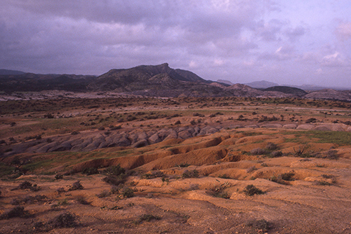
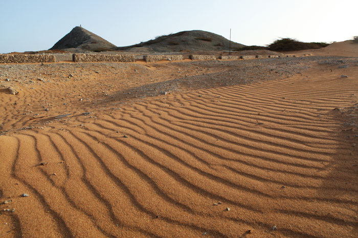
The journey we made was around the triangle formed by the titular mounts of Alta Guajira. This became apparent as we walked through the peninsula from south to north and from the west to the east, as we learned how teriomorphic beings – who existed outside of time, before the existence of humans- became hills, winds and stones; how beings of the sea can also be of the land; how certain historic landmarks indicate places that are visible footprints in the landscape.

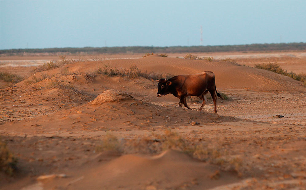
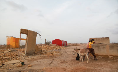
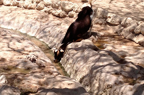
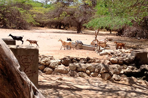
Geography has moulded the human activity of the Wayuu, and the people as well have moulded geography through the meaning and uses assigned to each mythic-historical place that exists there. These points in the landscape and their oral narratives have permitted through successive generations the ordering of ways of seeing the world; the beings that inhabit the sea and the land and who are part of the mythological universe, and who have determined the manner in which each living or mythological being defines themselves as masculine or feminine.

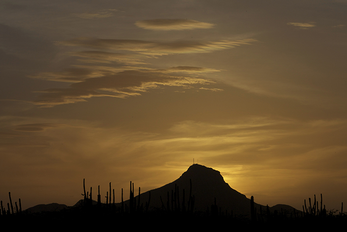
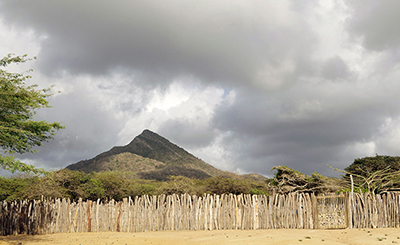
Some mythic stories of the Wayuu state that the titular mounts of Guajira came down from the Sierra Nevada in search of new prospects. Other stories affirm that they came from the west of Guajira. In the myths compiled by the anthropologists Perrin, Chaves, Bolinder and Caudmont1 Wilbert, Simoneau y Perrin, Folk Literature of the Guajiro Indians. , their journey is recreated:

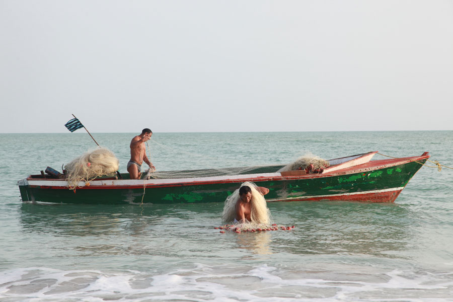
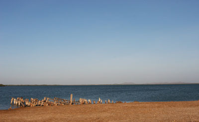
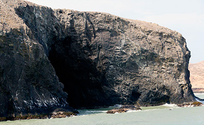
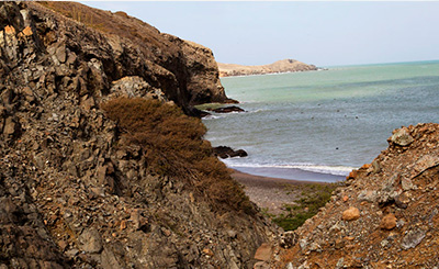
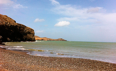
"The three brothers (sometimes presented as two brothers and a friend) wandered through Guajira in search of water and food. One day, upon arriving to the plains of the central peninsula, Epitsü told his brothers that he had fallen in love with a woman, and that he had become fascinated with this place that had the form of a beautiful breast, referring to what is today known as the Cerro de la Teta (the Mount of the Breast). The others continued until arriving to the Cabo de la Vela (Cape of the Sail). There Kama’ichi announced to his brother that he had fallen in love with the sea, that he wished to become a fisherman and that he would stay there forever. The third brother continued onwards to the edge of the peninsula, where he fell in love with the fertile land and running waters. There he stayed for the rest of his life".

Foto Kama’ichi por Jesús Abad Colorado
Kama’ichi|Photo: Jesús Abad Colorado

Each brother stays in the place associated with his desires. The common element in these narratives is the fraternity that marks the spaces, the presence of a kinship between brother hills that is always mentioned. However, in some narratives of Alta Guajira Kama’ichi is not mentioned, but rather the Cerro de los Monjes [Mount of the Monks], also called Waliraajo’u.

Foto Iitujolu por Jesús Abad Colorado
Iitujolu|Photo: Jesús Abad Colorado

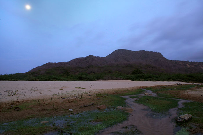
The triangle features a pathway, a micro geography and environmental setting, but as well evidence of how geography and landscape are constructed from social and kinship relations between multiple beings both living and mythical. In the social, familiar and mythical world of the Wayuu, the territory is perceived as an ancestral space, inherited through the maternal line, and never lost.


Foto Epitsü por Jesús Abad Colorado
Epitsü|Photo: Jesús Abad Colorado
Foto de la Familia Carrizal en la Guajira por Jesús Abad Colorado
Carrizal Family|Photo: Jesús Abad Colorado

As one can appreciate upon review of the stories, the history they tell instructs as to the dilemmas and challenges of survival in this semidesert landscape, where each day brings the risk of hunger, fatigue and thirst, the travels and the wise use of resources available to the Wayuu.


Journey made by the triangle that make up the three titular hills of La Guajira:

Map developed by Maria Luisa Moreno for the British Columbia University, Canadá

The Tortugas de Pajara


Our journey began in Carrizal, in the southwest of Guajira; about two hours from Riohacha and one from the town centre of Uribia. In Carrizal we encounter the first traces of a mythical and historical geography, represented by the tortugas de Pajara. They reveal to us not only the relationships between sea and desert, herdsmen (Aruleewi) and people of the shoreline (Apalaanchi), but as well the introduction of beef cattle by the Spanish in the sixteenth century.


Photo: Jesús Abad Colorado


In that period the Wayuu established active commercial relations with the Spanish, who had brought cattle to the Guajira relying on a notion that the centre of the peninsula was fertile, with plenty of available land and water for this human activity. This invokes the first western economic models adopted by the Wayuu, which came to transform symbols of wealth and status. As noted by Weildler Guerra “the stratification of Wayuu society begins with the introduction of cattle, and of new economic and technical elements at the beginning of the sixteenth century.”r 2 Guerra, “El poblamiento del Territorio Guajiro”, 143.


Photo: Jesús Abad Colorado

At present fishing is considered an inferior activity, and fishers as social actors of low status in the social order of the Wayuu. However, fishers

Do not accept this discrimination, and relying upon elements of the marine world oppose models of wealth and prestige equivalent to those used in the world of the interior. As such fishing is viewed as a kind of herding: the sea as an immense savannah of grazing land. Turtles are cows. Sharks are tigers. Lobsters are chickens, and fish are goats. The sea: an extensive and inexhaustible corral. People of the shoreline consider themselves free men whose wealth is safely contained in the sea, and as such they consider goat and sheepherders to be the slaves of their own animals, subject to the inclemencies of heat, theft and the plague. 3 Guerra, Los apaalanchi: una visión del mar entre los wayuu, 8.

Photo:  María Luisa Moreno
Photo: María Luisa Moreno

In the tales associated with this place it is said that the tortugas de Pajara left the sea by night and hid there before dawn. Upon leaving the sea they became cows, and went to graze near Pajara creek in Carrizal. One day the Wayuu surrounded them to prevent their escape. Some fled towards the meadows of the sea, but caught by the light of the sun turned into stone. The midday sun on the salt flat can create a mirage where the flats seems full of water, and the rocks a herd of cattle struggling to return to the sea.

Photo: María Luisa Moreno


This story stands out for its eloquence in explaining the relation between sea and land, between shepherds and fishers. Guerra describes how for Wayuu fishers the sea is a gigantic corral in which animals graze without danger; safe from summers, diseases, theft and the ravages of war.

These stories and the image of the sea as a great corral circulate and update themselves in contemporary conflicts such as that of the state and the Wayuu over the salt flats of Manaure, found between Riohacha and the Cabo de la Vela. The symbolic difference between sea and land is also reflected in the cosmogony of the Wayuu. One example is found in the stories of the existence of a Pulowi of the sea and Pulowi of the land compiled by the anthropologist Michel Perrin in the 1970s and 1980s. Listen to Carmen Cuadrado Fince Uriana history

Pulowi is a feminine mythical being made manifest in places bearing its name. She is sovereign and owner of wild animals and possesses a great marine wealth: corals, turtles and fish who graze in the wide meadows of the Caribbean. All Pulowi are wives of Juya (the rain). Perrin tells that

Pulowi from the deep sea was the wealthiest. She had much cattle, turtles, fish and other marine animals, she possessed red jasper and jewels of all kinds. Pulowi of the land was poor: her herd was but venison, roe deer foxes and few other animals 4 Perrin, El camino de los indios muertos: mitos y símbolos Guajiros, 68.

Fishers establish equivalencies to refer to all terrestrial animals as coming from the sea, as in the case of the tortugas de Pajara who convert into cows in order to inhabit the hostile and dangerous environment of the land. These stories narrate the challenges of life in the desert, and the ways that social tensions are negotiated arising from the differing and greater status now granted to pastoral herders over fishers. As well, they make manifest the close relation between sea and land, and their complementarity in the life of the Wayuu.


Julirianalü:
in the waters of the Cabo de la Vela


Traveling toward the titular Mount Kama’ichi we paused at the Cabo de la Vela [Cape of the Sail], one of the corners of the Guajira full of the traces and transcendent sites of the Wayuu mythic geography. Guerra describes this part of the journey:

To arrive one has to pass through the dry riverbeds of the Wayuu settlements to the south, named Ishotshiima’ana, Koushotchon and Pujulu’u. Then one enters the town proper, with its housing and tourist lodges. The hilly zone to the north is named Uuchitu’u, full of places forming an extensive and intertwined mythic geography. 5 Guerra, “Del Cabo de la Vela a Nazareth”, 12.

The hill of Julirianalü is a site where Pulowi heals creatures of the sea. This place was historically named as such, and according to the Wayuu author Glicerio Tomás Pana it meant “winged butterfly emerging from the waves”. For fishers Pulowi heals the fish who escape from their nets, from their hands and boats, and carries them back to the sea.


Photo: Jesús Abad Colorado

Upon seeing this white rock the Spanish, led by Alonso de Ojeda, thought it looked like a ship’s sail and hence the name Cabo de la Vela: “from far away the white excrement of marine birds seemed to them a ship’s sail. They named this symbolic and geographic landmark the Cape of the Sail, as it is known as to the present day.” 6 Guerra, “Del Cabo de la Vela a Nazareth”, 12.

Arriving at this point one feels the strong trade winds that characterize the desert territory of Alta Guajira. These winds shape the landscape and have great impact on the activities of daily life. The Wayuu, particularly fishers, recognize more than eight types of wind; 7 Guerra. El mar cimarrón. Conocimientos sobre el mar, la navegación y la pesca entre los Wayuu. each has its own character and is associated with climatic conditions and seasonal changes.

Two of these eight types of wind are known as Jepirachi and Aruleeshi; both are seen as feminine and antagonistic. Aruleeshi is the soft wind from the southeast who originally was a inshore fisher defeated by Jepirachi, the strong northeast wind and excellent fisher. Germán Barliza spoke to Guerra on the origin of the antagonism between the two beings:

Jepirachi was a Wayuu fisher that went far offshore, and Aruleeshi was a fisher who stayed close to the coast. One day Juya sent two young women to where Jepirachi and Aruleeshi were and said: ⎯Go and ask for some fish from my fisher grandsons, take with you cheese, meat and beans⎯.

The women arrived to the beach and encountered there Aruleeshi who was fishing early from the shore. Some youths (Aruleeshi) were there with parched skin. The women asked who was Aruleeshi. ⎯We are⎯, answered the youths.

The women said ⎯We have been sent by Juya so that you gift us some fish⎯. Aruleeshi’s catch was very scarce, a handful of catfish and stingrays thrown on the sand, and the women were not pleased. The women asked where is Jepirachi? Aruleeshi responded: ⎯they are far away, they will arrive late, it would be better to go away⎯.

Aruleeshi wanted the women to go away for shame at their scarce catch.

Jepirachi approached the shore, the air grew cold and Aruleeshi became anxious. He again told the women to go as Jepirachi would not come. Aruleeshi began to create winds to prevent Jepirachi from reaching the shore, but to no avail. Jeparichi began to unload a great catch of delicious fish such as carite, sierra, jurel and cojinuá. The women asked ⎯who is Jeparichi?⎯. And he responded ⎯I am Jepirachi⎯. ⎯We come on behalf of your grandfather Juya, to gift him some fish for dinner⎯, said the women. ⎯We brought milk, cheese, beans, pigeon peas and meat⎯. Jeparichi ignored the women, but calmly began to fillet the fish for Juya and handed it to them. They tossed aside the catfish and rays of Aruleeshi, and because of this there is rivalry between Aruleeshi and Jepirachi. 8 Guerra, “El universo simbólico de los pescadores wayuu”, 4.

Jeparichi, the strong northeast wind, was keenly felt as we moved from Julirianalü to Puerto Bolivar in Alta Guajira.

On this path we passed some traces of a more recent history: Puerto Nuevo and Bahia Portete. The inhabitants of Portete in 2004 had fled in terror when paramilitary forces of the Wayuu Counterinsurgency Front entered the town, assassinated four women and a man, tortured several people, desecrated the graveyard and destroyed homes.9Grupo de Memoria Histórica, Masacre de Bahía Portete: Mujeres Wayuu en la Mira.

Close to Portete, to the northeast, just 3 km from Media Luna we passed by the imposing windmills of the Jepirachi Wind Farm that, as a witness to a convergent and contentious history of war and development had entered into operation the 19 of April 2004; one day after the massacre of Bahia Portete. The strong trade winds of Jeparichi are the source and the motor for wind energy in fifteen gigantic windmills.

Pantu


Our journey continued into the Highlands of the Carpenter as we went inland from the Cabo de la Vela in search of the Pantu hill. This is found a short distance from Mount Kama‘ichi, and is better known as the Cerro Barrigoncito [Little Paunch Hill] for its small size and curved shape of a belly.


Photo: María Luisa Moreno

One Wayuu myth connects this hill to a man with a great belly, but above all a good fisher, hunter and with magical powers of transformation. The story presents this hill as Maleiwa. It tells of the man of the little paunch becoming involved in a dispute with Makuira for injuring her daughter, and how as a result of the conflict both became features of Guajira geography.


Jepira,
the entrance to the world of the dead Indians

From the Cabo de la Vela we went north to enter the world of the dead Wayuu. Jepira, in the oral and symbolic universe of the Wayuu, is not a transit point, nor is it mythic or historic; it is where life and death meet, where the world of the living becomes the world of the dead. Jepira is a primordial space in the memory of the Wayuu. If it indeed has a physical setting, its character is primarily associated with “another world,” the beyond.


Photo: Jesús Abad Colorado

When searching for Jepira we were sent in different directions. The majority of people we asked claimed not to know its location. At last a Wayuu family told us they knew the way. In Wayuunaiki (the Wayuu language) the father called one of his children to accompany us. At a brisk pace the son guided us across and then down a hill to the edge of the sea, bordered by large metamorphic rocks.


Photo: María Luisa Moreno

There was not a person to be seen, only the sounds of the sea and the movement of animals amidst the stones. As mentioned by Perrin in The Way of the Dead Indians, few Wayuu desire to see this place given that it is considered grim and dangerous. Its name signifies the land of the dead Indians.

another in Jepira. It is for this reason that the Wayuu are buried two times. In the first the deceased is prepared for the journey to Jepira: their face is covered so that the soul prepares to leave home and family. Souls do not journey to Jepira alone but are accompanied by the animals sacrificed during nine days of mourning.

The second burial occurs when the person has arrived to Jepira and has become a yoluja (‘spectre’). During the second burial the skeleton is exhumed to be cleaned by the senior women of the family, who are charged with its care, protection and reburial in the maternal family territory. It is there that the soul is lost forever. Jepira then is the site of passage between the worlds of life and death. In narratives collected by Perrin several Wayuu affirm that the souls of the dead return to the land as rain.


Photo: Jesús Abad Colorado

Puerto Bahía Honda


Upon leaving Jepira we headed towards Bahia Honda, a place full of the vestiges of interactions of the Wayuu during the colonial period. Bahia Honda speaks to us fundamentally as to the significance of the colonial and republican periods, and their utopian ideas of this territory.


Photo: Jesús Abad Colorado

In this bay we encounter the history of the region and its strategic valour: the failed attempts of Alonso de Ojeda, governor of Coquibacoa ⎯previously the north of the Guajira peninsula⎯ to erect the first Spanish settlement in 1502; the hundreds of indigenous uprisings; the military campaigns of pacification during the sixteenth and seventeenth centuries; and the production of salt in the nineteenth century.

Photo: Jesús Abad Colorado

The Guajira peninsula has been conducive to the conception and failure of utopiansThe first utopia was by Alonso de Ojeda who founded in Bahía Honda, in May of 1502, the first Hispanic settlement of South America (Santa Cruz). It only lasted four months because the utopian dreams of finding pearl banks and green stones failed and the hostility of the indigenous population grew.

For Arevalo, el pacificador [the pacifier], establishing a pacified settlement in Bahía Honda was essential "given the importance of the port where the guajiros stocked arms and ammunition and maintained active commerce with the English in Jamaica." In 1773 San Joseph of Bahia Honda is founded, but the warlike pressure of the Indigenous wayuu led to its abandonment in 1779. Bahía Honda became the main port of supply for the wayuu and from there harassment expeditions departed to conduct guerrilla warfare against possessions.

Notes taken from: Bahia Honda: Ephemeral foundations and utopian cities. 2007
. Perhaps this is because it has been seen as rich in natural resources but marked by a type of constitutive violence, born in part by the view during colonial domination of the territory as legally empty and unconquered.

Photo: Jorge Mario Múnera


In the eighteenth century, a Spanish merchant, Fernando Ruiz de Noriega, proposed the foundation of a new city to be called San Fernando, on Bahia Honda, with two fortifications, and for this he solicited a licence from the Crown to recruit one hundred thousand sailors for the construction. A century later, in 1815, the very Liberator himself, Simon Bolivar, conceived in his celebrated Jamaica Letter the placement of the capital of the future Republic of Colombia in Guajira, imagining

[…] a new city with the name of Las Casas, in honour of this hero of philanthropy, based in the confines of both countries in the superb port of Bahia Honda. This location, although not well known is advantageous in all respects, with easy access and with a situation so strong as to be impregnable. It possesses a pure and healthy climate, a land suited to both agriculture and cattle ranching and with abundant supply of wood. The savages that inhabit the land will be civilized, and our possessions will grow with the acquisition of La Goajira. 10 Simón Bolívar, Carta de Jamaica, 26.

These and other colonial and settlement projects in Bahia Honda and its surroundings and the Wayuu resistance to these missions survive in oral narratives of the Wayuu until the present.

Carmen Fince Uriana y Vicente Gutiérrez narration

Enramada Luma


Upon leaving Bahia Honda, heading towards Nazareth we find Mount Luma, that much as described by Weildler Guerra during the journey reminds us of a gigantic enramada [arbor] of stone.


Photo: María Luisa Moreno

As we approach Makuira, we see the imposing Mount Iitujolu, the senior brother of Kama’ichi and Epits.


Photo: Jesús Abad Colorado
Photo: Pilar Riaño Alcalá

According to an old story, the mountainous formations of Makuira, Simaura and Cosinas are the daughters of a powerful chieftain from the Sierra Nevada de Santa Marta, who as punishment had converted them into hills. The girls had disobeyed their father’s dictate that they not leave the ancestral territory due to the dangers they could face; one moonlit night they had left seeking adventure. Makuira, the favourite daughter, weeps since then and her tears, hidden in a thick curtain of clouds and mist, create the numerous streams that sustain and make possible the life of men and women. Makuira is the punished mount, spilling her eternal cry in the form of water.


Photo:Pilar Riaño Alcalá
Photo: Pilar Riaño Alcalá

Wolunka:
the woman of the toothed vagina


In Makuira Park we arrive to Wolunka. This enormous black rock with red stains reminds the Wayuu of the story of one the primeval women of Wayuu myth. The rock is surrounded by green desert vegetation and water passing by in a small stream.


Wolunka | Photo: Jesús Abad Colorado

Wolunka is the daughter of the rain, Juya. She was born with a toothed vagina, without the possibility of reproduction, and as such without human descendants. Wolunka liked to bath nude in the streams. On one fine day a pair of twins who often hid to observe her daily rituals shot some arrows at her the moment she was entering the water. The arrows entered directly into her vagina and knocked out the teeth. Her blood not only stained the water, but also some of the surrounding rocks. Wolunka fell unconscious into the stream; the twins carried her out and laid her onto the rock that to this day keeps the traces of this important history. According to Weildler Guerra the blood also bathed several birds of Guajira such the iisho or the guajiro red cardinal, which we saw while leaving Makuira, and marine birds such as the tokoko or the pink flamingo.


Shortly after losing the teeth in her vagina Wolunka had children. These in turn reproduced until becoming the Wayuu people, the most numerous indigenous population of Colombia. The rocks stained with the blood of Wolunka will remind us always of the beginnings of the Wayuu.


Photo: Jesús Abad Colorado


On the path towards Alaasu, we encounter a well of natural subterranean water known as an eye of water. On a flat stone erected upright as a notice one reads “Wüia, Blessed of living God”. The temporary migrations of the Wayuu through their territory are undertaken fundamentally in the search of fresh water. During times of drought many families move to less arid zones to obtain better access to water. The springs and jagüeyes (natural water cisterns) are indispensable for life in the desert.


With limited access to water like that characterizing any desert, the Wayuu for centuries have related to the land with wisdom and creativity. Knowing the types of wind, the location of the water eyes, the wealth of the sea and the construction of cisterns, among other things, they have survived long periods of drought. They have forged distinctive and surprising forms of inhabiting and comprehending their space; beginning with their knowledge, and the relation between the human and the non-human.

Cerro Polojolii: the mature man

Close to the titular Mount Iitujolu, we sight the Jala’ala highlands, which are known as “hard stone”. It is from here that we commence the descent towards the south of the peninsula. Within a few kilometres we encounter the Polojoli hill, which is to say “mature man”. The top of the hill is white, hence the name, which mimics a head turning grey. We then head towards the Alaasu rocks, found to the southeast of Iitujolu.

Photo: Jesús Abad Colorado

Alaasu Rock:
that which tells of origins


The Alaasu rocks are found in the Makuira highlands in the north of Guajira. It was there that Maleiwa gave to the Wayuu their clan emblems, which represent the foundation of their social organization, relationships of solidarity, and which regulate the tenure of cattle ownership.


Cattle are branded with these symbols to distinguish between clans. Some brands are now not used, as the clans they symbolize have cease to exist.

As well, the branding irons and emblems have a biotic character; for the Wayuu they live, with heads, feet and bodies, with components of meaning much beyond the character of iron. The animals represented in each seal are charged with dictating the norms and protecting the members of the clan.

Photo: Jesús Abad Colorado

The Alaasu rock tells also of the effects of encounters between the Wayuu and Spanish merchants and settlers; sometimes friendly, at times confrontational, but always intense. This is due to that, as indicated by ethnologist Michel Perrin, the iron symbols were an influence of Spanish colonial society. They were adopted as a result of exchanges with the Spanish, and with time became the symbols which identified each Wayuu clan.

Some Wayuu Clan Emblems,
their meaning and geographical reference 11 Castaño Uribe, Sierras y serranías de Colombia, cap. 7.


WAYUU
EMBLEM

CASTE

MEANING

TOTEM

LOCALIZATION

Aapüshana Friends of shared blood Samuro: samüt Cojoro Walitpana
Paüsayuu The protectors of the home Repelón Guajira Central
Sijuana The brave sentinels of the tribe Wasps: ko`oi Upper Guajira
Juusayuu The noble and brave Prairie snake: kasiwanot Central Guajira
Uliyuu Those that calmly walk Anteater: walit Upper Guajira
Uraliyuu The feathered brave Rattlesnake: ma´ala Cerro de la Teta
Uliana Those of stealthy steps Tiger, cat and rabbit Upper Guajira
Jaya´aliyuu The always ready Fox, dog: apüche y erü Upper Guajira
Epieyuu The natives of their own home Cataneja: autaoropo Upper Guajira
Pushaina The hurtful, those of boiling blood Wakiros, ko´oi Central Guajira
Iipuana Those who dwell on the rocks Falcon, karikare Central Guajira
Ulewana The noble trackers Lizard
Epinayú Those who strike hard in the path Deer, the king of vultures Upper and middle Guajira
Jirnuu Those of thick tails Fox Shoreline
Woluwoouliyúu Those of a whitish colour Partridge No information
Waliliyúu o Wouliyúu Those of light feet Twilight birds No information


Clan membership amongst the Wayuu functions primarily to accentuate lines of loyalty, respect and aid in each group. Some territories are associated with certain clans, but actual patterns of residence do not strictly conform to this.

Kusina Highlands


In the distance we see the Kusina Highlands, found to the southeast of Uribia, and a little north from Mount Epitsü. Kusina is also part of the mythic and social geography of the Wayuu, and oral narratives let it be known that few Wayuu dare to go there. They affirm that the inhabitants of that land are a specific group of indigenous people, also known as the Kusina, that is to say mysterious hunters. According to Perrin the term “Kusina” is used to refer to those far away, distant or disappeared.


Photo: Jesús Abad Colorado

Until the twentieth century and even to the present, the Kusina were not considered a tribe, but rather a group of persons expelled for bad behaviour and destined to live apart from other clans. For many Wayuu, the Kusina ended up creating a violent group that thieved and prevented any stranger from entering their territory. Perrin mentions that at the beginning of the twentieth century those who were thought of as well off or rich had to do with how much cattle a matrilineal line possessed. As such, to not possess a herd was, in this moment of history, to be a Kusina Wayuu; that is to say a marginal or a savage Indian.

Photo: María Luisa Moreno

Wososopo


Following a straight line from Epitsü, the last titular mount, we encounter the imposing Mount Wososopo. In some Wayuu stories it is part of the titular mountains of Alta Guajira and is presented as a friend of Epitsü, Kama’ichi and Iitujolu coming with them from the Sierra Nevada. Juancito Iguarán narrates that “Wososopo was so thirsty that he could not take one more step. —My lungs are dry— he shouted at his companions, but he continued to walk as he watched them disappear into the distance.” 13 Wilbert, Simoneau y Perrin, Folk Literature of the Guajiro Indians.


Photo: Jesús Abad Colorado

The task of completing the journey, guided by the triangle formed by the titular hills of the Alta Guajira, ends at Epitsü, also known as the Cerro de la Teta (the Mount of the Breast), after three days. This journey through mythical and historical places, of other worlds, reveals the existence of a physical and spatial realm hosting a mythic and social Wayuu geography. It gives meaning to the histories of this people.

These places speak to us of conceptions of kin, social status and gender; of the relations between beings of the desert and beings of the sea, between hills and wind; about the long path between life and death that every Wayuu must follow. To move through these spaces and hear their stories permits us to evoke the forces that animate living beings, and the material world where animals become stones, humans become mountains, and winds battle amongst themselves to gain strength at certain hours of the day. As well the traces of colonial and republican history remind us of failed utopias; which never achieved the subjugation of the Wayuu, or the imposition of a worldview upon them. The profound vitality and complexity of the Wayuu continues to recreate itself each day in the geography of their territory. Even if this historic and mythic geography suffers from the impacts associated with the violence of modernizing enterprise, of war and of a nation that stigmatizes it, the Wayuu continue strengthening and recreating themselves in their knowledge and their territory.

Epitsü, Cerro de la Teta | Photo: Jesús Abad Colorado